The worst impacts of the unfolding climate crisis, on both people and ecosystems, will be felt through its effect on water. In India, erratic monsoons, prolonged dry spells and extreme rainfall incidents are already overwhelming its 1.3 billion citizens.
Relentless groundwater extraction, unprecedented pollution of surface water, and alienation of communities from their water resources have further compounded the water stress situation across the country.
It doesn’t have to be this way. For decades, environmentalists and social scientists have repeatedly pointed to India’s long history and diversity in water harvesting and conservation. For centuries, Indians have crafted ingenious water conservation system of all size and varieties that channel water from rivers and monsoon runoff and nearby hills and elevated areas.
The water is usually directed to storage tanks, sometimes built in a series, with overflow from one becoming runoff for the subsequent one, like Talaabs, Pokharas, Ahars, Johads, and Eris. There is a plethora of such traditional, low-cost, easy to maintain, and community-run examples of water systems all over the country.
A number of these ancient traditional water harvesting, and irrigation practices have survived the test of time and social upheavals and continue to give sustenance to communities through periods of water scarcity.
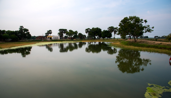
Ahar Pyne of Bihar
Jalsar
Ahar, Siur, Nawada, Bihar. Ahars are reservoirs with an embankment on
three sides while Pynes are diversion channels laid from the river or
the catchment area for impounding water in the Ahars and channels.

Bansi
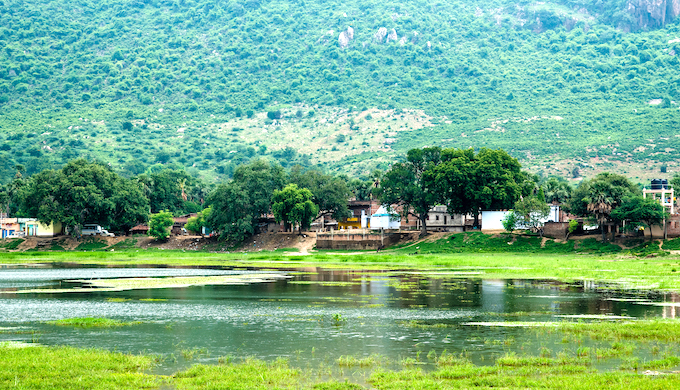
Mohana Pyne, Sakri River, Bihar.
Water supply for an Ahar comes either from natural drainage after rainfall (rainfed Ahars) or through Pynes, artificial channels constructed to utilise river water in agricultural fields. It is this system that made paddy cultivation possible in South Bihar, which is otherwise unsuited for this crop
Water supply for an Ahar comes either from natural drainage after rainfall (rainfed Ahars) or through Pynes, artificial channels constructed to utilise river water in agricultural fields. It is this system that made paddy cultivation possible in South Bihar, which is otherwise unsuited for this crop
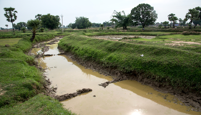
Pyne, Nawada, Bihar
Through this system, one Pyne can irrigate up to 400 acres. For decades, the system is not just used to collect, store, and distribute water but also hold people from various castes and classes together resulting in group action for irrigation operation and maintenance.

Farmers checking Pyne level, Nawada, Bihar
The area irrigated by the Ahar Pyne systems has witnessed a sharp decline and yet, even today, they constitute nearly three-fourths of the total irrigation facilities in south Bihar. More than 60% of these are defunct, and the rest is poorly managed.
These structures not only have relevance for sustainable water management but also have essential socioeconomic importance as it allows community participation and distribution of responsibilities simultaneously opening alternative avenues for earning a livelihood for the local population.
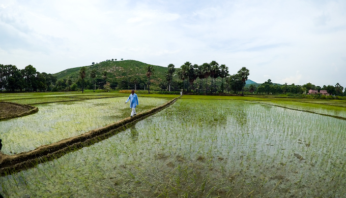
Paddy fields, Siur, Nawada, Bihar
Ahar and Pyne assist in controlling floods by distributing surplus water into its system. The routine upkeep work involves cleaning and desilting of Ahar and Pyne and maintaining the water conveyance network is done by the cultivators before the onset of monsoon.
All farmers grow the same crop (paddy) all over the irrigation command around the same dates. As a result, agricultural operations undertaken by all cultivators are similar throughout the irrigation command. Since Ahars and Pynes have to be used collectively, all farmers have to synchronise their operations.
Johad of Uttar Pradesh
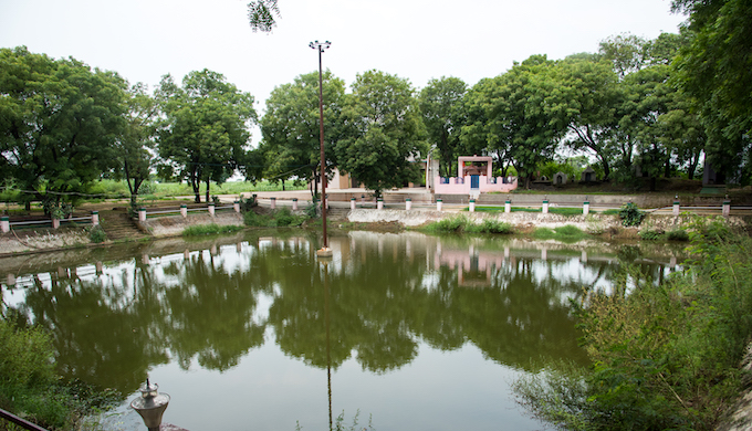 Baba Bhurewala Johad, Dhikoli, Baghpat, Uttar Pradesh revived by Development Centre for Alternative Policies
Johad, a crescent-shaped dam of earth and rocks found in Uttar Pradesh, Haryana and the Thar desert of Rajasthan, is probably one of the oldest rainwater harvesting systems in India. Archaeologists have dated some of these rainwater storage structures in India as far back as 1500 BC.
The water collected in a Johad during the monsoon is used for irrigation, drinking, livestock and other domestic purposes while recharging the groundwater. During the dry season, when the water gradually recedes, the land inside the Johad is used for cultivation.
Typically, building a Johad involves digging a pit and shaping the excavated earth into a semi-circular mud barrier. A stone drain is sometimes set up, allowing excess water to seep into the ground or connecting it with Johads nearby. When many Johads are built in one area, they have a cumulative effect, resulting in the replenishment of whole aquifers.
The height of the dam varies from one Johad to another, depending on the site, water flow, contours of the land, etc. In some cases, to ease the water pressure, a masonry structure is added for the outlet of excess water. The water storage area varies from 2 ha to 100 ha. The villagers share the expense, supply labour, and materials like stone, sand, and lime.

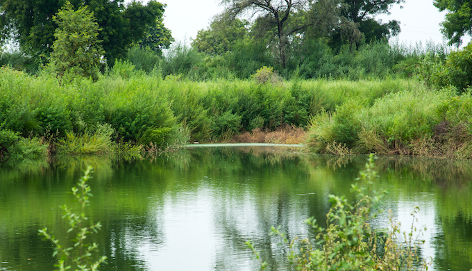
Reed bed channel, Dhikoli, Baghpat, Uttar Pradesh
In the last 20 years, several innovations have improved the efficiency of the Johads. An initiative by New Delhi-based Development Centre for Alternative Policies (DCAP) in the Dhikoli village of Baghpat district of Uttar Pradesh stands out for replication.
In 2001, the Dhikoli block of Baghpat district of Uttar Pradesh was declared a dark zone by the Central Ground Water Board due to excessive groundwater exploitation. With no sewage system in place, the ponds in Dhikoli, like other villages in Baghpat, were overflowing with domestic sewage. DCAP’s project included an innovative reed- bed system, also known as the biofilter system, for treating wastewater before it reached the ponds.

Shamshan Johad, Dhikoli, Baghpat, Uttar Pradesh
A 650 ft long channel — 8 ft deep and 10 ft wide — with weirs that had alternating tiny waterfalls and ditches brought the sewage water and rainwater overflow from the village drain to the lower Johad that was constructed on the panchayat owned land.
Since the project was completed and the three Johads have been able to capture around 5.5 million litres of rainwater per annum from the surrounding catchments per year, recharging the groundwater in the process. In addition, every year, 11 million litres of treated wastewater go into the newly made big Shamshan Johad. Several tube wells downstream of the Johads have also reported an increase in the water table.
Lower Shamshan Johad, Dhikoli, Baghpat, Uttar Pradesh
The efforts by local communities in India to improve water availability are lauded universally. A widespread revival of these traditional practices will contribute to India attaining its Sustainable Development Goals and ensuring water security, food security, and disaster risk reduction.
Extracted from Water Wisdom in Times of Climate Crisis, published by Oxfam India for the Transboundary Rivers of South Asia (TROSA) project.
First published on Indiaclimatedialogue.


